NH – Mount Moosilauke
A perfect hiking day (except for some summer haze) meant a perfect hike: 4000-footer Mount Moosilauke. We hadn’t hiked it since 2003, so it was time again (our fourth) and we needed to blog it anyway.
Mount Moosilauke is a 4,802-foot-high (1,464 m) mountain at the southwestern end of the White Mountains in New Hampshire. It is the tenth highest and most southwesterly of the 4,000 foot summits in the White Mountains.
There are a number of trails from different directions to access Mount Moosilauke, some of which are part of the Appalachian Trail. The most hiked routes are from the Dartmouth Outing Club Ravine Lodge on Ravine Lodge Road off Route 118 about 12 miles from Lincoln, NH. Many of the trails are maintained by the Dartmouth Outing Club (DOC).

From the lodge, the standard loop hike is the Gorge Brook Trail to the summit, and then the Carriage Road (to the south peak) and Snapper Ski Trail back to the start, about 7.5 miles round trip with an elevation change of about 2450 feet.
The hike turned out to be about 2 miles RT farther (walking along Ravine Lodge Road) because the Ravine Lodge was demolished and new structures are being built, opening in October 2017, so the improvised parking lot was about 1 mile from the start of the trail.
One of the nicer features of this hike is that most of the trail is easy to moderate with some steeper sections, with no water crossings (other than on bridges), and no rock scrambling or slab walking.
We started out on the Gorge Brook Trail, which initially runs along the brook then turns away and heads up, with a couple of scenic views along the way, then breaks out in scrub and soon a wonderful open summit area.
We descended from the road, crossed the Baker River on a bridge and turned left onto the trail.


We then turned right uphill alongside the brook. We crossed the brook at some point on a 4-log-wide single-railed bridge (not pictured here).

At .6 miles, the Snapper Trail diverged left (our return route) and we continued to the right on the Gorge Brook Trail. We soon crossed the brook on a three-log-wide single-railed bridge (not pictured).

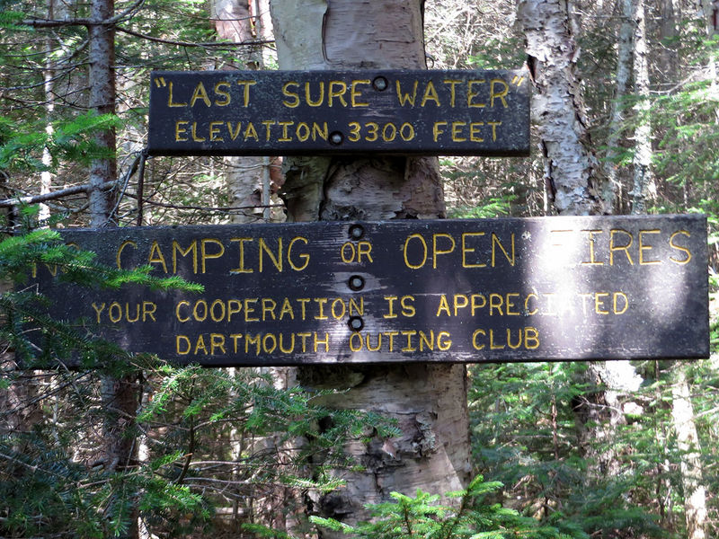
At about 1.5 miles (elev 3300 feet), we passed a “last sure water" sign. At 1.6 miles, the trail swung right away from the brook, ascending at a moderate (occasionally a little steeper) grade to the east and northeast.

At 2.1 miles (elev 3750 feet) we got a nice view at a cleared outlook — this to the southwest — of Smarts Mountain (right) and Mt. Cube (left).

At 3.3 miles, the trail reached a shoulder (on east peak) with low scrub with a view to the summit. Soon we reached a nice grassy ridge and continued up to the summit (elev 4802 feet).


Eating lunch in one of the rock shelters.
At the summit, you can see the Franconia Ridge, the Bond range, Waterville Valley, Lincoln, and Loon Mountain (Loon is off the picture to the right).

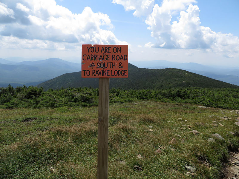
After our long, leisurely lunch, we headed along the Moosilauke Carriage Road, a nice wide trail with beautiful vegetation, and mostly scrub, so there was sun and a nice feeling of openness. At about 4.5 miles from the start (0.9 miles from the summit), the Glencliff Trail (the AT) and a spur path to the south peak diverged right. Until that point, the Carriage Road was part of the AT from the summit. At about 5.6 miles (2 miles from the summit), we turned left onto the Snapper Ski Trail, headed back down to the junction with the Gorge Brook Trail, and then followed the Gorge Brook Trail back to our start.


It took us about 2 hours and 20 minutes to get to the summit and a little less coming down (not counting the mile to and from the car). All told, we left the car at about 9:30 am and were back at the car at 4:00 pm (this was roughly 9.2 miles–about 7.4 miles on the mountain and about 1.8 to and from the car).
In the following maps the path we took was counter-clockwise. The path between the points labeled Start and End was the one mile walk along the road from the car to the trail.

