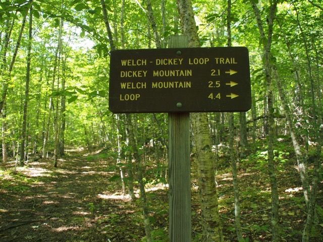
NH - Welch-Dickey Loop
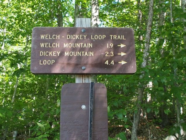
A classic, the Welch-Dickey loop hike features hiking up granite slabs in a 4.4 mile loop, 1800 feet elevation change, 3 hours, 5 minutes. With the promise of great views on a beautiful but hot day, we chose this hike to do with our friends Franklin and Joanne Hooker. Dickey Mountain is on the "NH 52 with a view list".
Note: This is a popular hike and there are many people on the loop on most summer weekends, and although it is not a "hard" hike, it is not an "easy" hike. Given how much of it is on rock slabs it is also a hike to avoid if the ground is wet or rain is forecast.
The hike starts on Orris Road, off Upper Mad River Rd, which in turn is off NH 49. There is ample parking there, and it’s a WMNF lot, which means there is a small parking fee unless you already have an annual (or senior lifetime) pass. The trailhead is at about 1060 feet.
This loop hike, with two peaks, Welch and Dickey, works best in the counter-clockwise direction, with Welch first, and then Dickey, as the granite slab pitch up to Welch is pretty steep in spots and something you want to hike up, not down.
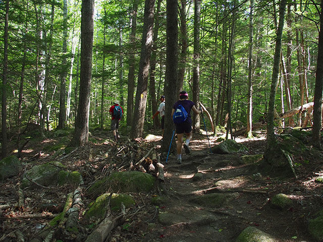
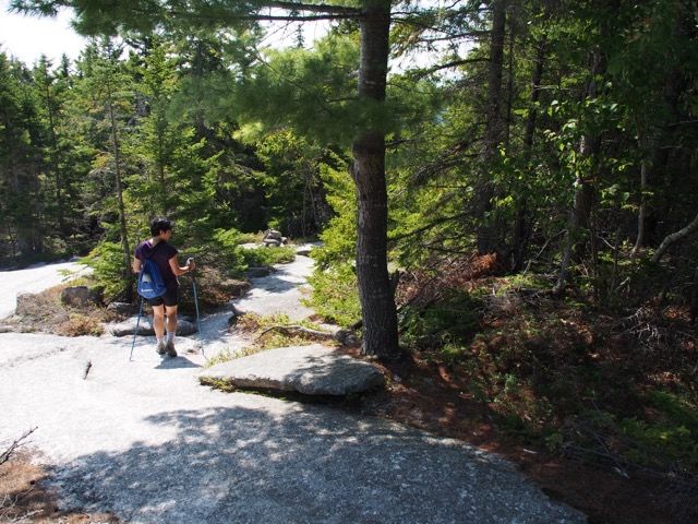
Upon starting, the trail almost immediately has a right-hand fork for Welch Mountain. The trail soon crosses a brook, follows its east side for a bit and then starts to angle up the mountain.
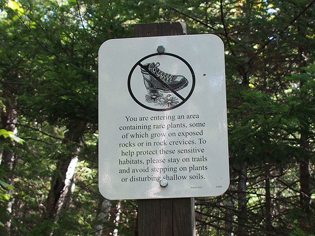
Just before breaking out of the woods, there is a sign telling hikers to be careful not to tread on sensitive revegetation areas.
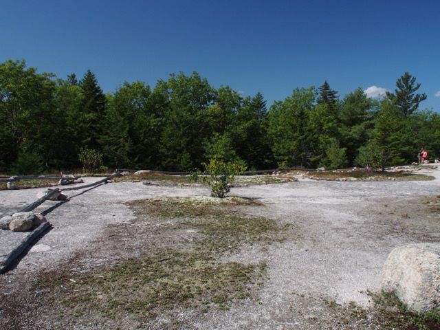
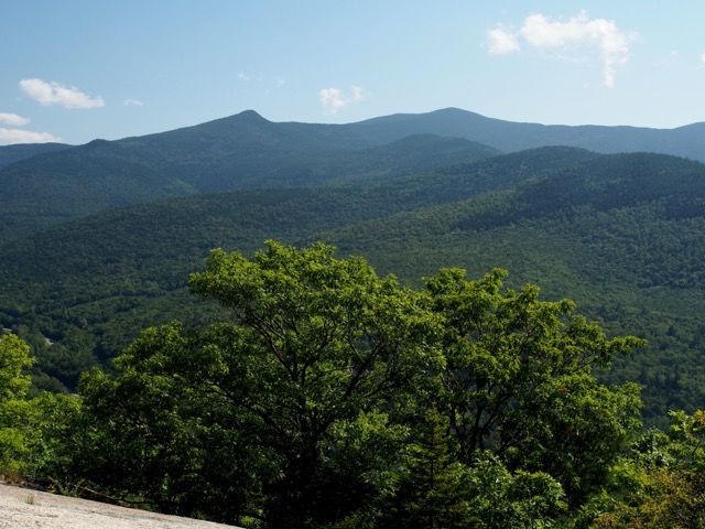
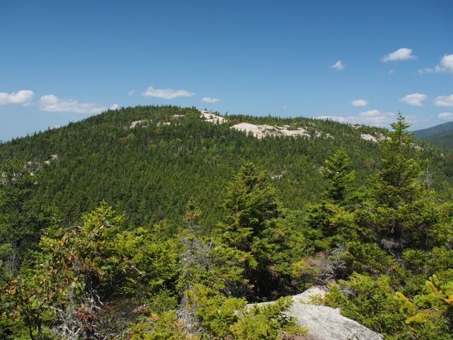
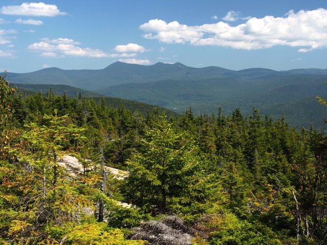
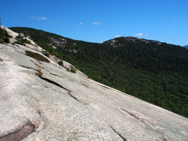
At about 1.25 miles (elev: 1775 ft) the trail opens onto large, flat, open ledges after a sharp right hand turn to avoid the revegetation areas. Here’s looking back.
The view to the east is spectacular, with Jennings Peak (the pointed peak on the left which we blogged back in July, see here) and Sandwich Dome most prominent. To the left just off this picture is Mt. Tripyramid.
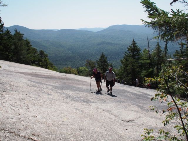
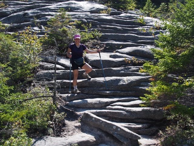
The trail climbs. rather steeply at times, on open ledges and scrub, and occasional rock scrambles. Here are Joanne and Franklin heading up a slab.
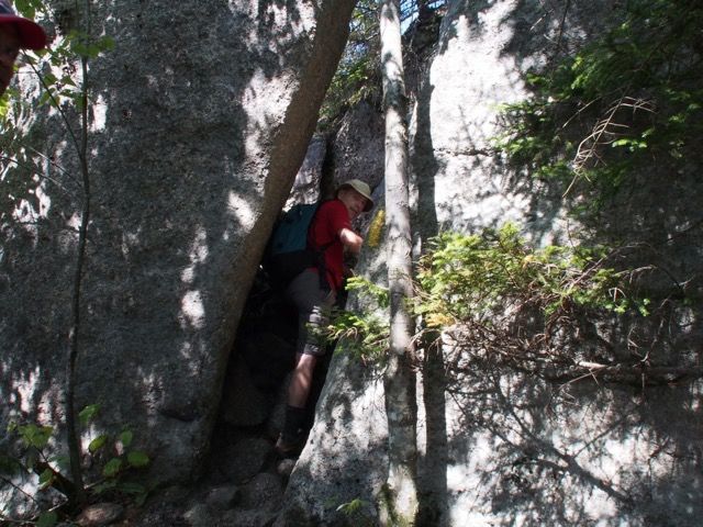
Larry working his way through a crevice on the trail.
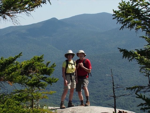
Welch Mountain is reached at 1.9 miles and at 2605 feet. Franklin posed for us with the Tripyramids and Waterville in the background.
We found some shade where we weren’t trampling on sensitive vegetation and had a snack, looking at our next destination, Dickey Mountain.
As we headed off down to the col between Welch and Dickey, we took these shots.
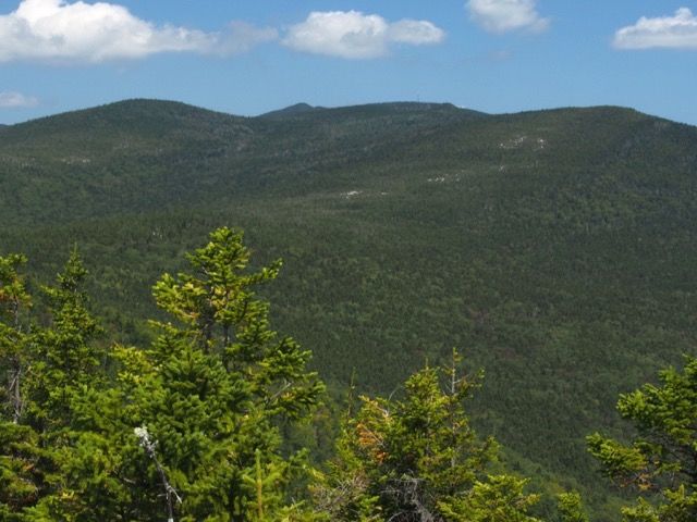
Here is Mt. Tecumseh to our north (and a little east), with the transmission tower on a spur.
And here is Mt. Moosilauke to the west.
Heading down to the col, the slabs are a little tricky here and there, with a cliff to the right. Although a bit steep in a few places, it only drops about 120 feet from the summit of Welch (to about 2480 ft.).
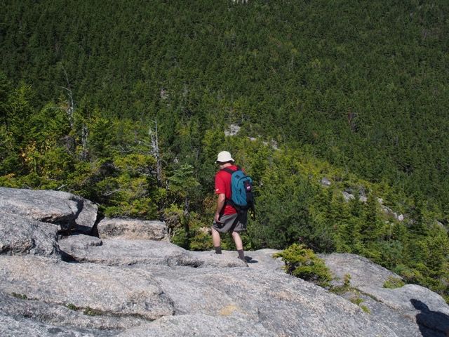
Larry heading down.
Joanne down off Welch.
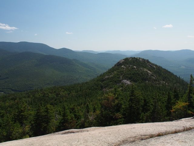
We arrived on top of Dickey at 2.3 miles into the hike, at 2734 feet.
Looking back at Welch Mountain looking southeast.
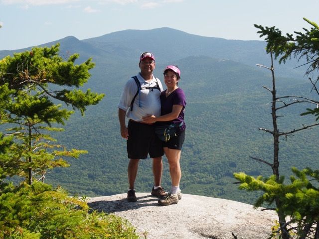
Time for some shots, again with our backs to Jennings Peak and the Sandwich range.
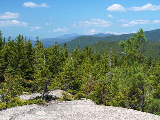
We found a nice spot for lunch, and relaxed. There is a .2 mile spur to a north outlook, but we did not take it. Next time, as the description says it has great views of the Franconia ridge, which we could see, but not quite as well, from the summit of Dickey.
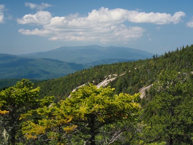
Here’s another shot of the Tripyramids.
And here is a shot of Cannon through the trees on the left and the Franconia Ridge in the distance just left of center in the picture. We were a bit confused at what we were seeing, but confirmed it when we got home and did some checking.
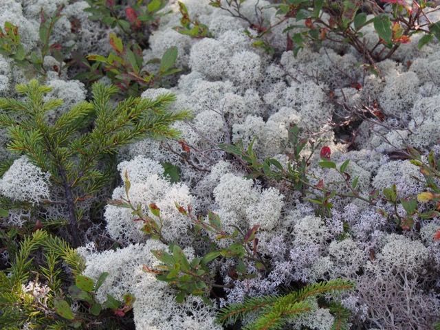
Reindeer lichen.
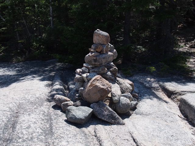
Our path down in the shadow behind the cairn.
The trail down alternates between scrub and slab.
A little up here.
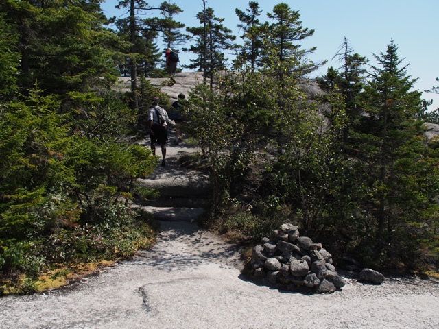
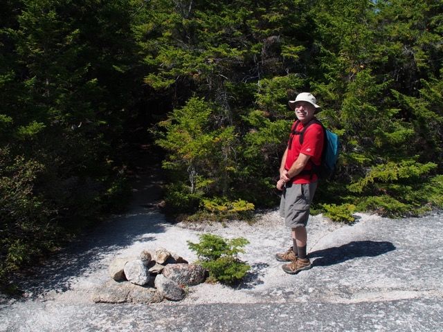
This cairn is pretty easy to spot :)
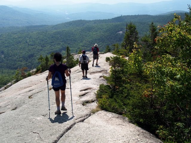
A wonderful ledge with an impressive drop-off at 3.2 miles.
Looking back to Dickey and Welch.
Soon after the ledge, the trail drops into the woods
Almost done at this point as we turned onto a logging road, and soon reached the first loop junction and then the road.
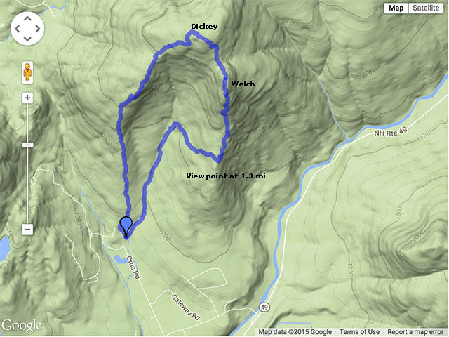
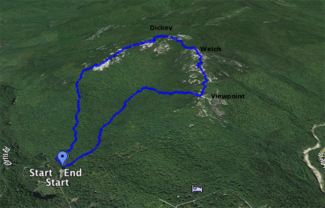
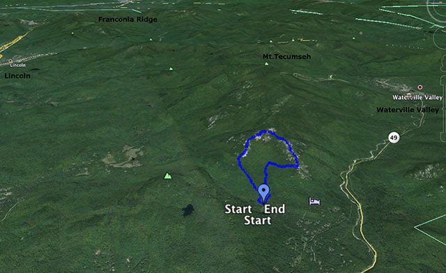
As you can see on the satellite view, from the Viewpoint onward (going counter-clockwise) a lot of the hike is over rock slabs (some of which are pretty steep).
Welch-Dickey is a very popular hike. The trail is easy to follow when it is in the woods. It is blazed with yellow. On the rocks there is a combination of blazes painted on the rocks (some faded) and cairns.
Our ratings (see the rating table):
Bang for the buck: Medium-High (a lot of work but some really nice views)
Length of trip: 3/5 (4.4 miles)
Strenuous: 3/5 (at the high end of 3 with some stretches of 4 and 5)
Trail composition: 3/4
Ease of following trail: 1/3
Larry and Eileen Samberg – 6-Sep-2015
Larry and Eileen Samberg– 23-Jun-2022