NH – Cannon Mountain
On a beautiful fall day in the 50s, we chose to hike Cannon Mountain, a 4000 footer (elev. 4100 feet). The last time Eileen hiked this was in 1980, and the last time Larry hiked it (with Leah) was in 1988 or 1989. The tram, which operates in the summer, was closed for the season, so we knew we wouldn’t have crowds at the top.
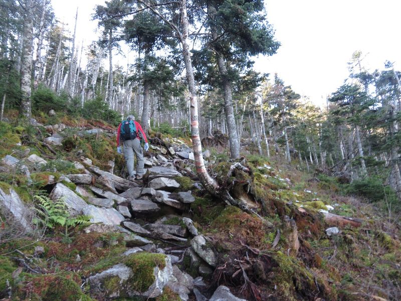
We picked the Kinsman Ridge Trail, which leaves from the southeast corner of the tram parking lot and heads up roughly parallel and south of the tram line. The hike is listed as 2.2 miles with about 2130 foot elevation change, which even on average is considered steep. In this case, the last .7 miles goes up 300 feet, which means the first part is that much steeper. In addition, there is a lot of challenging rock scrambling and slab negotiating that require a lot of concentration. The hike was that much more difficult because recent rains meant that the rocks were all wet and in many places the trail had water streaming down.
[Caution: This is not a trail guide. If you are planning to do this hike, consult a real trail guide (for example this one), have a map, compass, and other reasonable hiking equipment.]
We started out at 10:15 am at the east end of the Cannon tram parking lot. The sign says 2.1 miles — but some guides say 2.2 miles.

A relatively steep start, first time out of the woods after about 10 minutes.

Some of the next section of the trail was pretty eroded. This was about 15–20 minutes into the hike.

We crossed this old ski trail four times on trail switchbacks — this shot at 10:52 am. Looking up the ski trail.

Looking down the ski trail.

Lots of bouldering/rock-hopping on wet surfaces — very hard work requiring lots of concentration. This was about 40 minutes into the hike.

Slabs — wet slabs —with water trickling down.

View of Bald Mountain and Artists bluff mid-picture, with Echo Lake in the right foreground. This was about an hour into the hike.

Up and up.

We switched left at about an hour and 20 minutes into the hike, which according to guide is the point where we finally diverge for good from the old ski trail. At that point on the Google earth map (below), you can see the trail goes left and the old ski trail (marked in yellow) goes straight up to one of the current ski runs, but we were busy switching left and didn’t really notice the old ski trail at that point.
Below is the point where the trail makes a sharp right turn to the east summit at about an hour and 40 minutes into the hike. We went straight on a side path toward the cliffs for a bit to get some nice views and then came back and made the turn. This is at 1.5 miles at 3800 ft, 1850 feet up from our start (pretty steep). [AMC book time is calculated at 2 miles an hour and a half hour for every 1000 feet of elevation, so we were pretty much on track].

A zoomed shot of the observation tower at the summit of Cannon at about 1 hour and 45 minutes into the hike.

And the un-zoomed shot.

Up through the scrub about 2 hours into the hike. Next stop, the observation tower.

A nice view back of the east summit and Lafayette across I-93.

Almost there. This is where a number of trails converge include the Rim Trail that runs between the observation tower and the tram house.

This is at 2.2 miles and 4050 feet, up 2150 feet from the start, 2 hours and 15 minutes from when we started.


View of the summit chair and tram station from the observation tower.

We ate lunch on a nice granite bench below the summit.

Very windy at the summit and the shrub.

We very carefully made our way down the very slick and tricky trail back to the car, arriving at about 3 pm.


Total time for hike, including climbing the observation tower and lunch, was 4 hours and 35 minutes. The hike was 4.4 miles round trip, starting from 1970 feet, rising 2130 feet to 4100 feet. We would class this as a pretty difficult hike.
Length of trip – 2: 4.4 miles (a little more for wandering over to the tram station and back) round trip.
Difficulty – 4 or 5: Very steep in parts.
Trail composition – 3: Lots of rock jumbles and slab, also erosion.
Ease of following trails – 1: It’s a very popular trail.