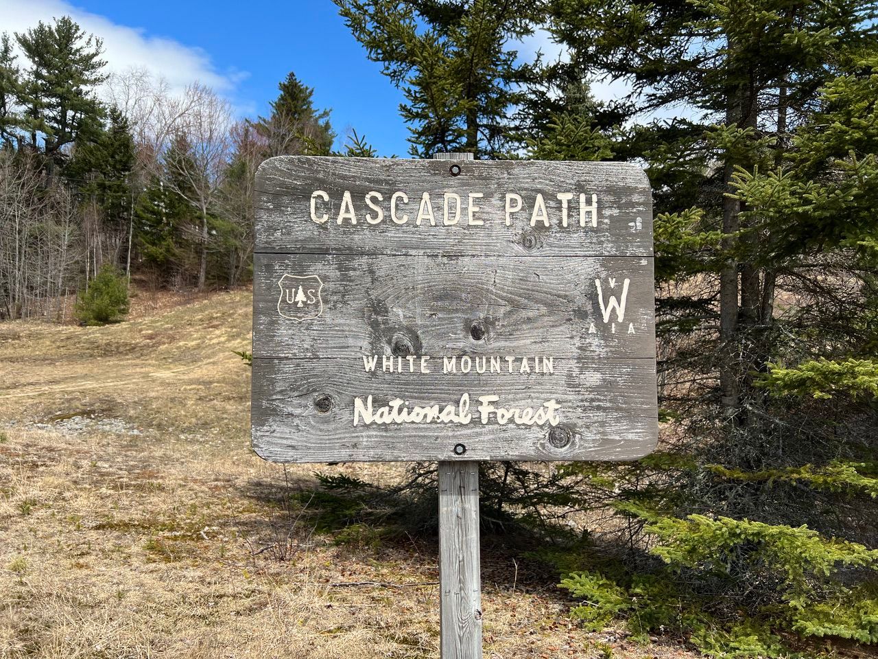
NH – Cascade Path (Waterville Valley)
As a starter hike this spring, we did a loop hike that we was roughly what we did a number of years back (in the opposite direction). Since we haven’t blogged it, it must have been quite a long time ago.
A number of this trails are multi-use -- hiking, biking, and cross-country skiing, and at major trail intersections, there a map with a "you are here" star. The trails are relatively well marked with yellow blazes.
Immediately to the east of the Waterville Valley Ski Area on Mt. Tecumseh is a small mountain called Snows Mountain. Snows Mountain has an old, small double chair lift that is still in operation for the ski academy at the base.
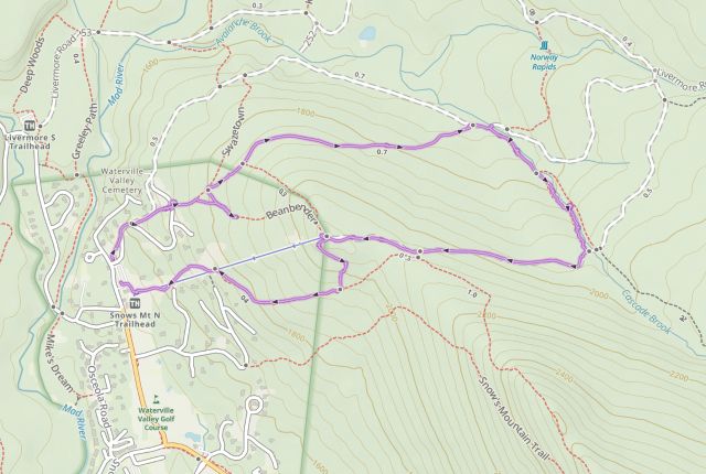
A bit north of the ski lift is Cascade Brook, which comes down the mountain in an amazing sequence of small cascades and waterfalls. This is a moderate hike. It is not long (about 3.4 miles for the loop we did) and it is not steep, but the trails and footing are variable, mostly smooth and easy to follow with some areas of rocky areas that have to be traversed. We would rate this a great family hike if you skip the Greeley Ledges Trail.
We hiked the loop clockwise, starting in the parking lot at the base of the Snows Mountain chair lift (elev 1520 ft).
The first part of the Cascade Path parallels a roadway for a while. There are several houses along the road and there was a fair amount of construction on this day. At the point where we entered the woods (about a quarter mile in, elev 1700 ft), there was a nice view of the the Waterville Valley Ski Area.

We continued along the Cascade Path. Soon, there was a sharp left onto the Swazetown Bike Trail followed quick by a sharp right to stay on the Cascade Path — we missed this, ended up on the Beanbender Trail, and needed to backtrack a few hundred feet.

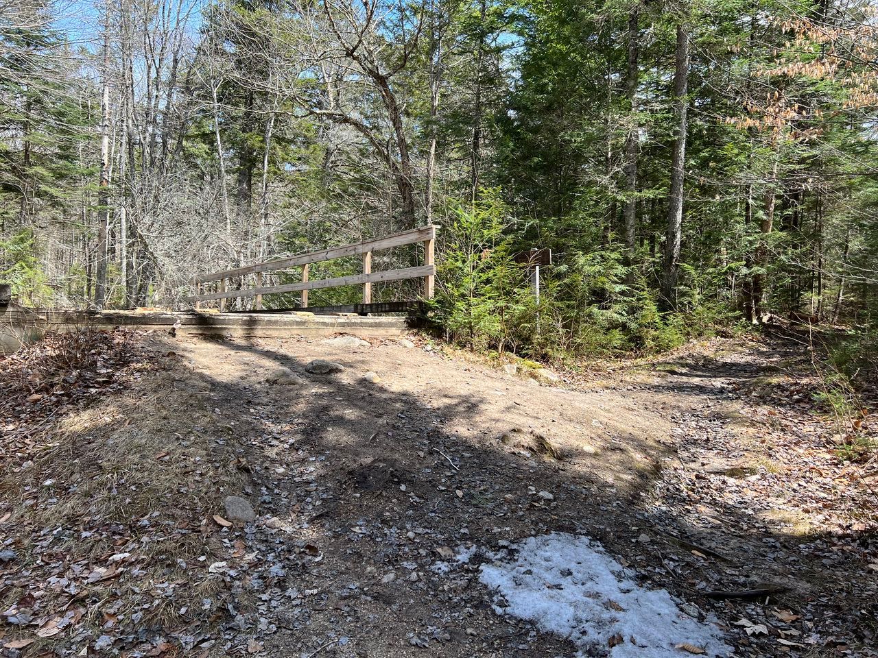
Eventually the Cascade Path reaches Cascade Brook. It meets the Lower Snows Mountain Trail at about 1.15 miles (elev 1672, a little lower than the previous elevation). A few yards farther along there is a bridge that crosses the brook to the east (north) side, but we stayed on the west (south) side. (We went down the trail on the right side of this photo.)
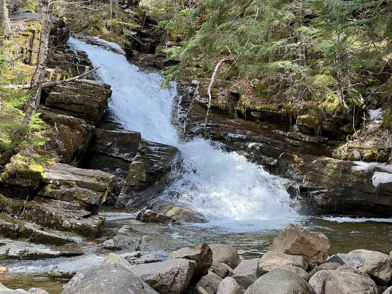
From this point we walked about 0.6 miles up along the west side of Cascade Brook, seeing one cascade and waterfall after another for the entire stretch.

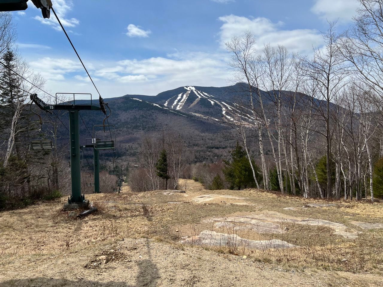
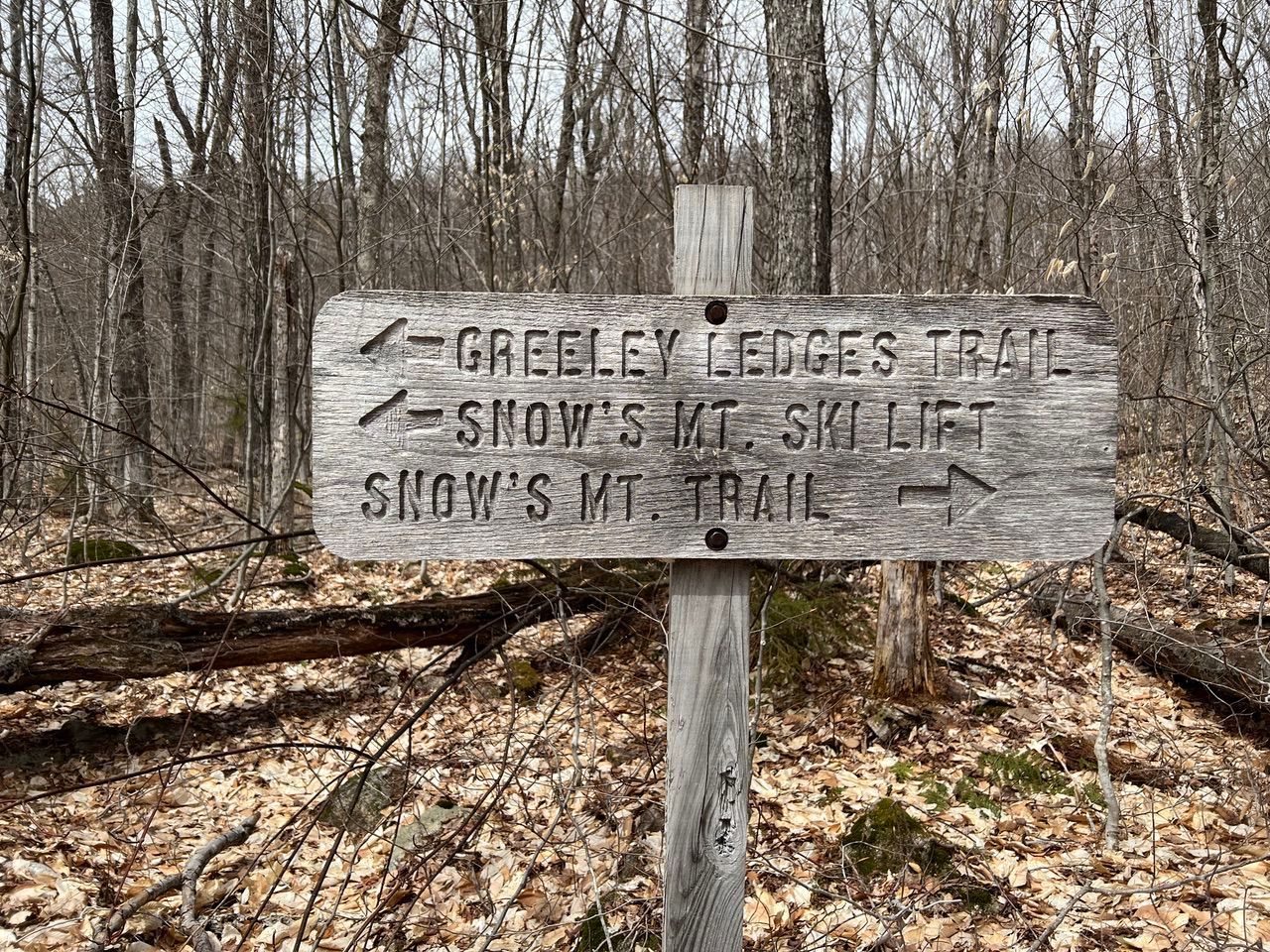
At 1.6 miles (elev 1944 feet), we reached the Upper Snows Mountain Trail. Turning left would take us across another bridge to a continuation of Cascade Path and the Upper Snows Mountain Trail. We turned right and took the Upper Snows Mountain Trail 0.9 miles to the top of the chair lift (about 2.5 miles from the start and elev 2087) and another great view of Waterville Valley.
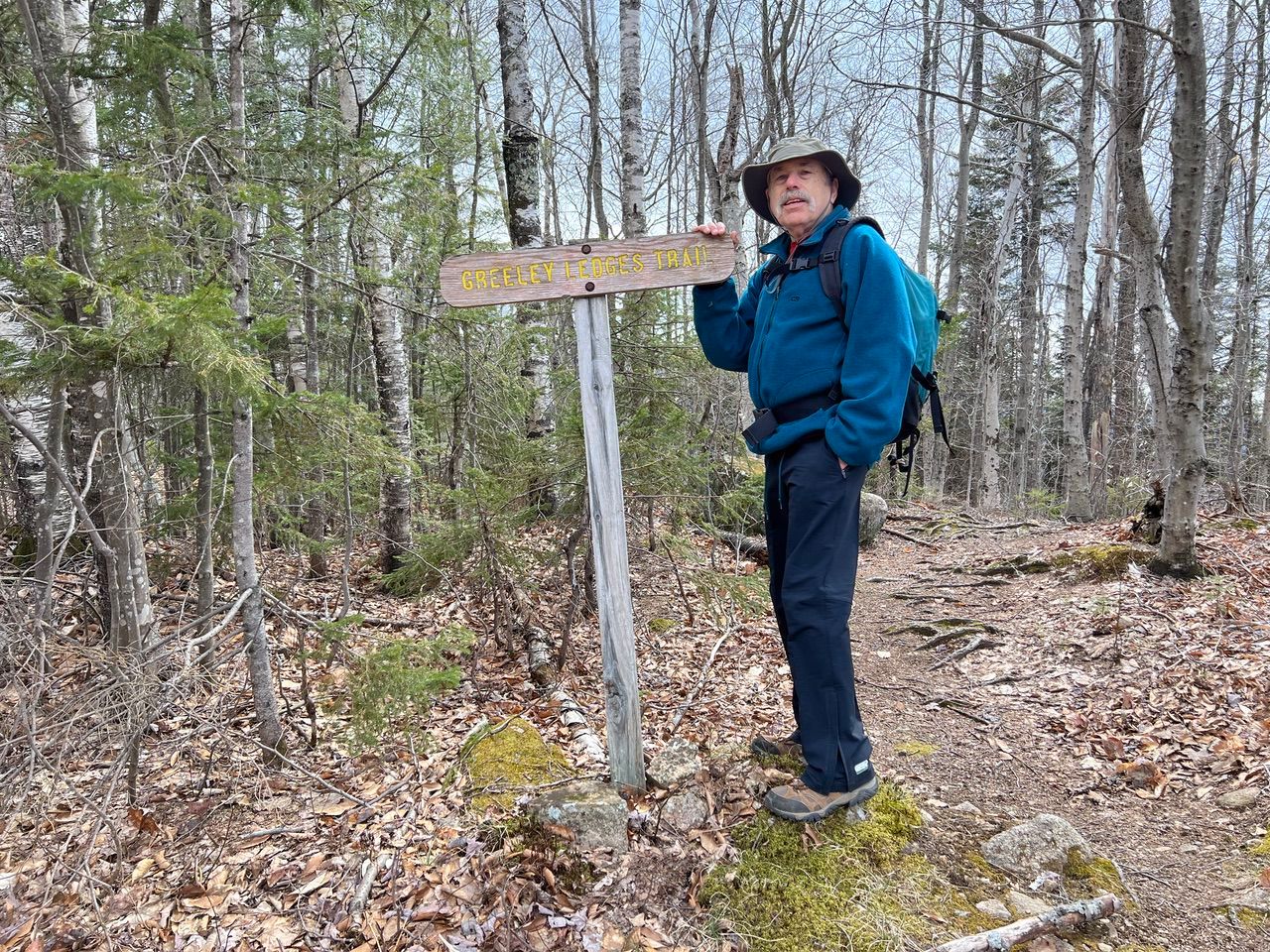
At this point we took the Greeley Ledges Trail downhill. These section was the only real rocky part, and care was taken to navigate it.
Looking back up after the trail leveled out.

After a short while it merged with and became the Snows Mountain Trail.
This trail exited the woods onto the ski trail under the lift at about 3.1 miles (about 0.6 miles from the top of the chair, elev 1751). From there we just walked down the ski trail under the chair back to the car.
The whole trip took us about 2.5 hours (including time for pictures, etc.) and covered about 3.4 miles. There was a total of about 550 feet of elevation from the starting point to the highest point (the top of the chairlift).
Larry and Eileen Samberg – 29 April 2022