NH – Mt. Cube
Continuing our quest to work down the "NH 52 With A View" list, we hiked to the summit of Mt. Cube. Since this is outside of the White Mountains, we’ll provide a little bit of context first.
Mt. Cube is on the Appalachian Trail, south and west of Mt. Moosilauke. The AT enters New Hampshire at the Connecticut River crossing into Hanover (at Dartmouth College). It winds its way east a bit and then heads north over a few minor peaks. The last two peaks before entering the Whites (at Mt. Moosilauke) are the most prominent in the area –– Smarts Mountain (3238 ft) and Mt. Cube (2909 ft). Mt. Cube has the Connecticut River Valley to its west and the Baker River Valley to the north.
There are three trails up Mt. Cube. The AT from the south (from Smarts) is the Kodak Trail. At the summit, the AT continues north on the Mt. Cube Trail. The third trail is the Cross Rivendell trail from the west. This is actually the easternmost 2 miles of a 36 mile trail that begins in Vermont, maintained by the Rivendell Trails Association (http://crossrivendelltrail.org/). This is the shortest way up to the top of Mt. Cube and our choice.

The trail starts about 0.9 miles in on Baker Road, a gravel road off of NH 25A at an elevation of about 1350 ft. It starts with mild grades. The first part of the trail had several wet areas. At about .5 miles it begins a gradual ascent via switchbacks, and at about 1 mile the forest changes from hardwoods to conifers, at which point the trail gets a bit steeper, continuing with switchbacks.

Note: Sometime in the last few years the trail has been re-routed and several straight, steep sections were turned into switchbacks. So the old trail crosses the new one a couple of times and runs co-incident with it in a few places. But the trail is clearly marked with light blue blazes and there was never any time that we were confused about where the trail went.
The trail continues like this for a while. The footing was good and the switchbacks climbed steadily.
At about 1.3 miles there is a clearing with a good view to the west with Sunday Mountain closest and most prominent. This is at about 2270 feet of elevation. At 1.5 miles the trail crosses a large rock ledge with a more spectacular view westward (elev. about 2500 feet).


After the ledge, the trail flattens out and descends a bit and gets a bit boggy.

At about 1.7 miles the trails crosses a brook — really just some water flowing over the rocks across the trail. After this the trail approaches the summit and the last quarter mile or so is walking/scrambling up large rocky ledges to the summit.


The south summit had excellent views to the west and south. Below is Smarts Mountain.

Below is the Dartmouth Skiway.

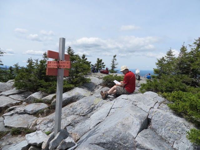
The north summit is about 0.3 miles further on. You start down the Mt. Cube Trail (AT) a little way. After about 0.1 miles the Mt. Cube Trail turns right and a spur continues straight for another quarter mile to the northern summit.

From the north summit, the Baker River valley is immediately visible with Upper and Lower Baker Ponds. The most prominent mountain, of course, is Mt. Moosilauke to the northeast. In the distance many White Mountain peaks are visible including both Kinsmans, Hancocks, Osceola, the Tripyramids, etc.


A few interesting pictures: Silver-bordered Fritillary sitting on Sheep Laurel and three shots of interesting quartzite.

It took us about an hour and 35 minutes to reach the summit of south peak. At 2909 feet, the climb was about 1560 feet over 2 miles. Total distance for the hike was 4.60 miles.
(Note that the Google Earth picture below is rotated 90 degrees).


For much more information about Mt. Cube you should read Steve Smith’s writeup.
Our ratings (see the rating table):
Bang for the buck: High
Length of trip: 3/5
Strenuous: 3/5 (with a few areas of 4)
Trail composition: 2.5/5
Ease of following trail: 1/3