NH – Mt. Roberts
On a sunny and not too hot day in July, we decided to hike Mt. Roberts in Moultonborough, another peak on the 52 With A View list, about an hour drive from Lincoln. Mt. Roberts is in the Ossipee Range, and is part of the Lakes Regions Conservation Trust's Castle in the Clouds Conservation Area. It offers beautiful views over Lake Winnipesaukee, and at the peak, some views north to the White Mountains including Mount Washington. Parking is at the top of Ossipee Park Road.
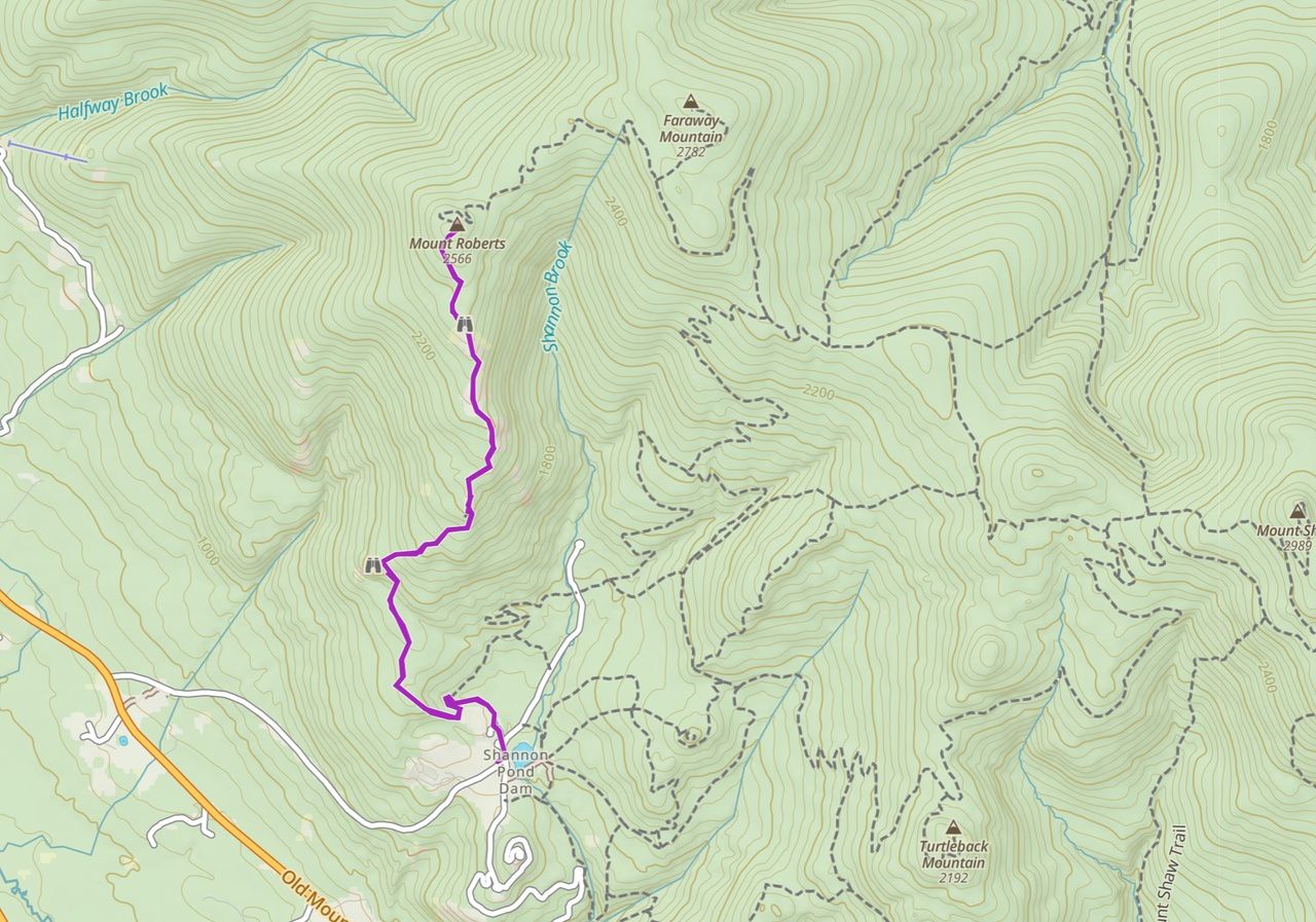
The hike is 4.5 miles round trip with a 1350 feet elevation gain to a height of 2,582 feet. The orange-blazed trail offers a easy to moderate ascent through both woods and open areas, and footing is generally good, with some rougher sections and small amounts of rock outcroppings -- and lots of low-bush blueberry.
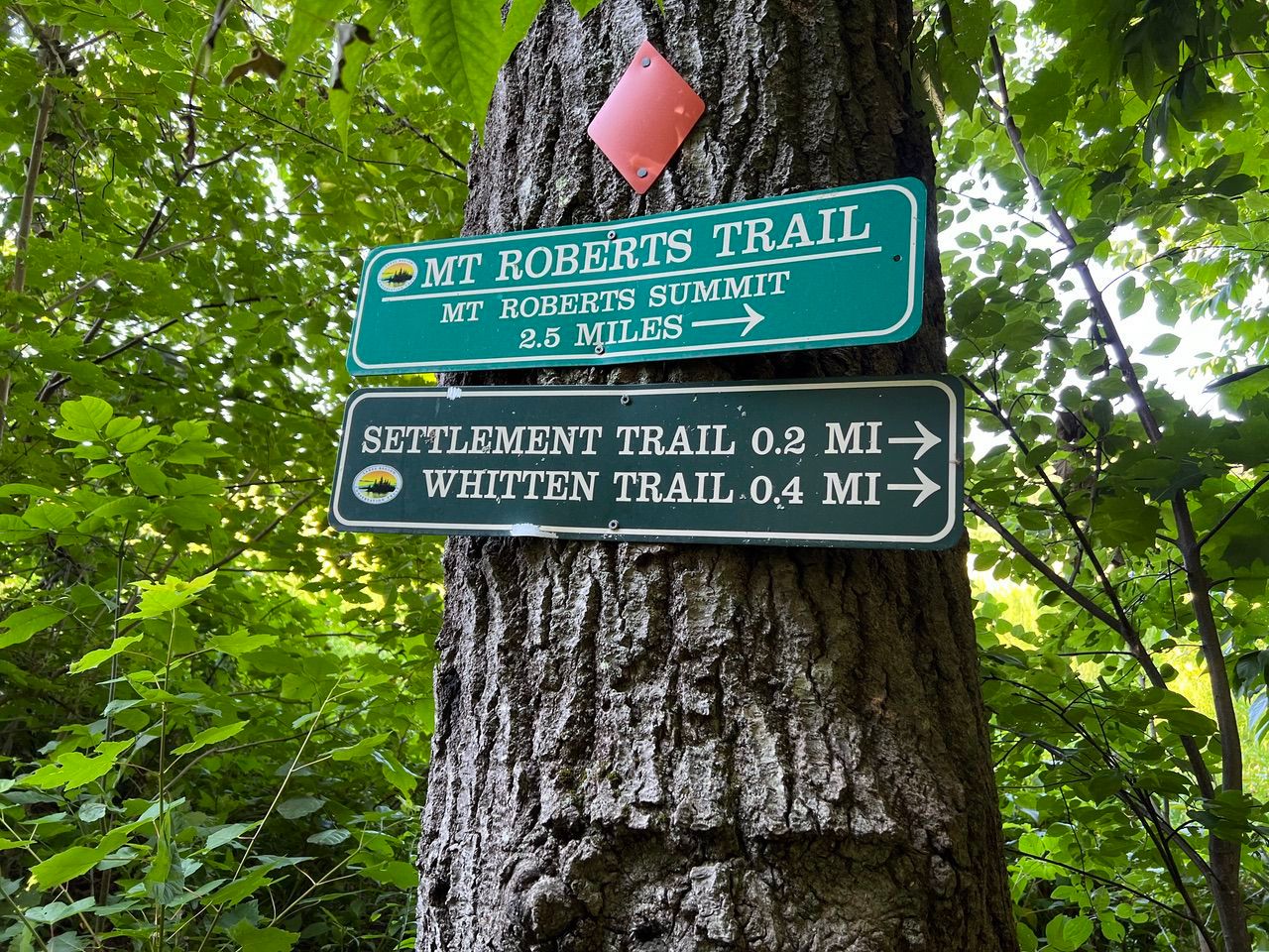
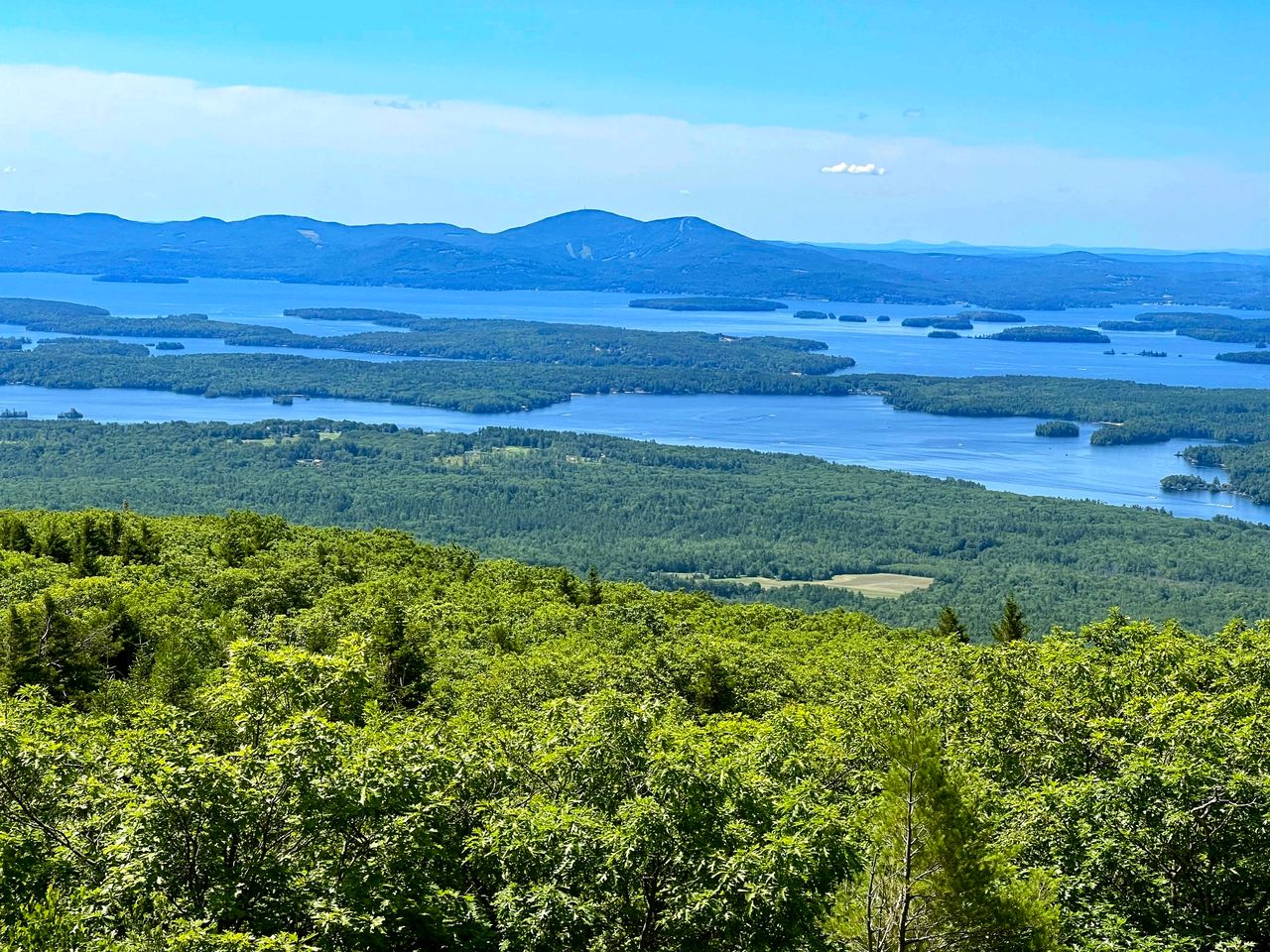
The hike starts at a parking area on Ossipee Park Road (elev 1250 feet). The first half mile or so was a wide trail with mild slope. At 1.2 miles (elev 1620 feet), a short-side path leads to a large open ledge with views of the lake. Mt. Kearsage in Winslow State Park in Wilmot, NH can be seen in the far distance.

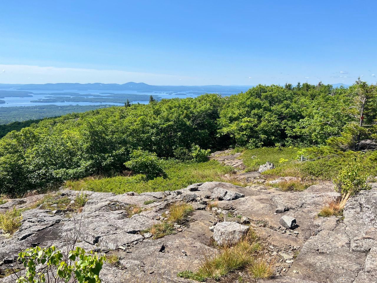
We walked in woods and in open areas with similar views. The path that where we walked out of the woods is just right of center in the picture below.
A view of Gunstock with its ski trails.
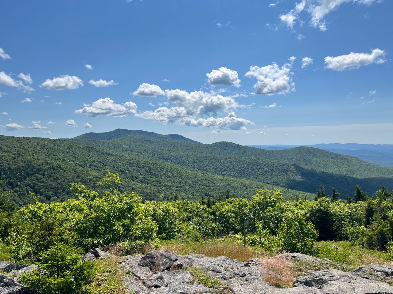
Mt. Shaw and neighbors, another (52 with a view) hike in the area.
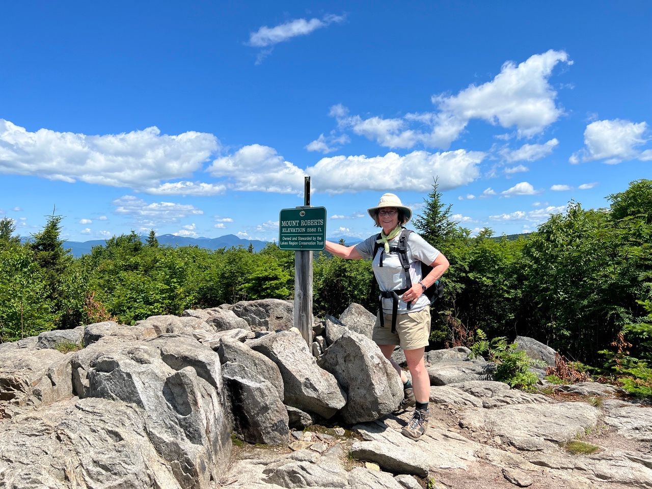
Eileen at the summit with views to the north (from atop the rock outcropping).
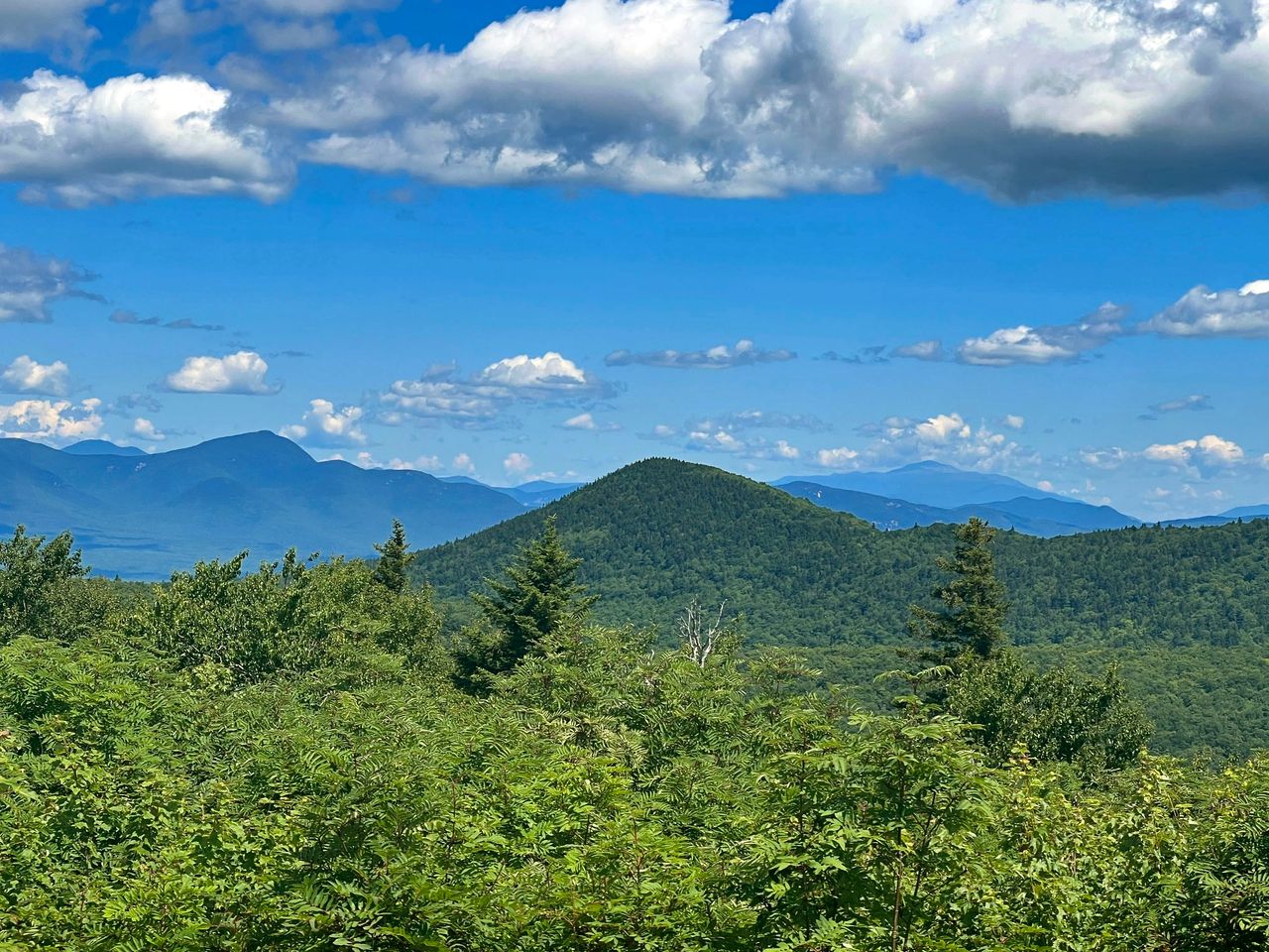
Mt. Carrigain (far left all the way back) peaking up over the bowl between Mt. Whiteface and Passaconaway, and Mt. Washington (right all the way back) can be seen through the haze.
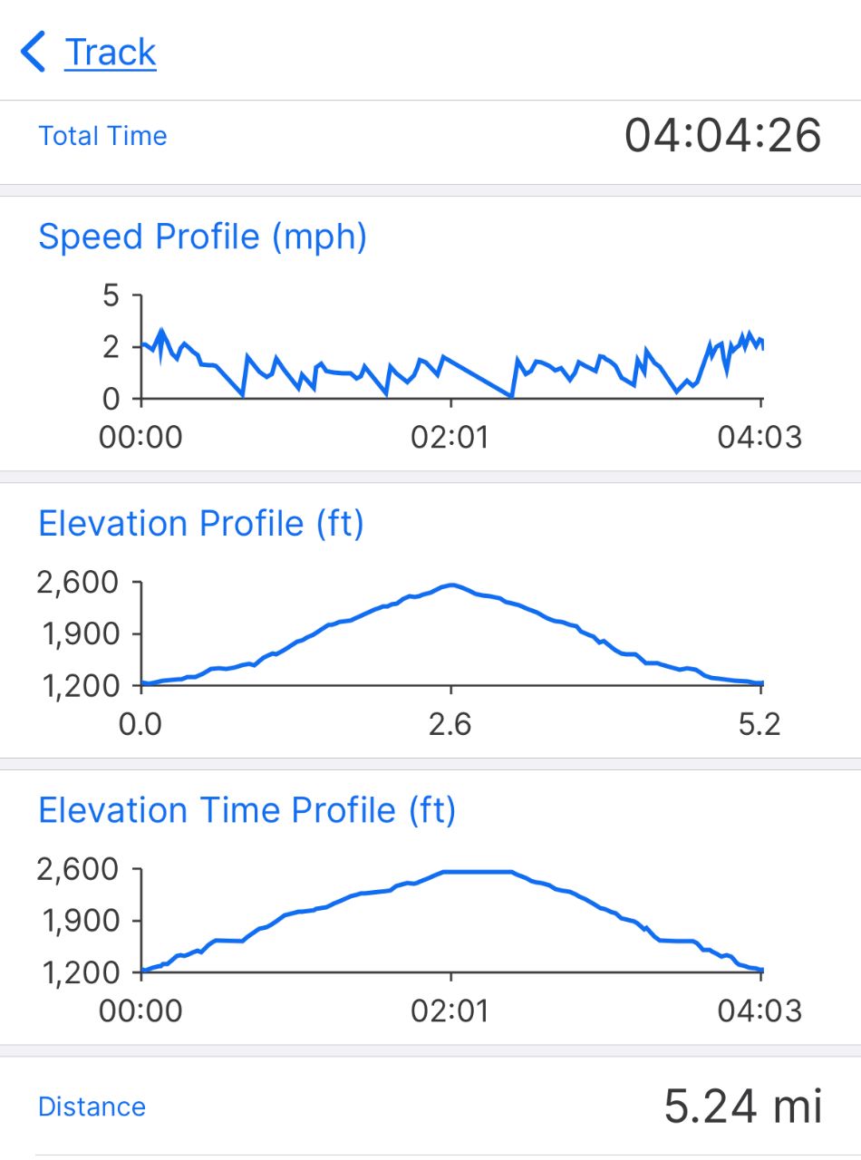
Our hike. It took us about 2 hours to get to the summit including stops at the various viewpoints and stops to take pictures. The walk down was about an hour and a half.
— Eileen and Larry Samberg, 15-Jul-2022