NH - The Sisters
Continuing our attack on the “NH 52 With A View", we hiked the “The Sisters".
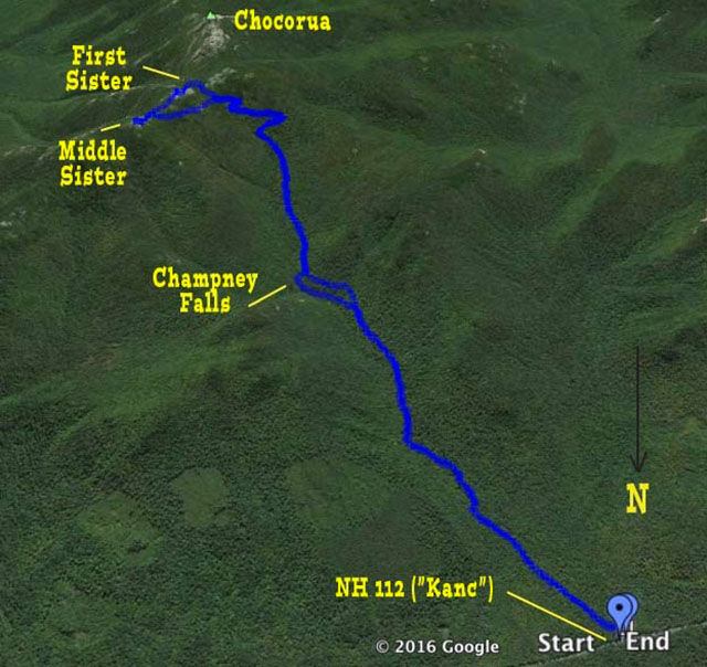
Anybody who has driven around the eastern end of the “Kanc" (NH 112) has seen the imposing peak of Mt. Chocorua (imposing in spite of the fact that its elevation is only 3480 feet). But this is not about Mt. Chocorua. We’ve hiked up Mt. Chocorua a couple of times (before we started blogging so we will have to do it again) but the mass just north of Mt. Chocorua is called the Three Sisters because it has three minor peaks around 3300 feet (so it they aren’t much lower than Chocorua). The Three Sisters have a single entry on the list, though some versions of the list have Middle Sister. We hiked Middle and First Sister. The full hike that we did was a moderate hike (about 7 miles RT and a couple of thousand feet of elevation) but with no major challenges.
The hike starts on the Champney Brook Trail on the south side of the Kanc. This is the primary approach to Mt. Chocorua from the north. The trail is very well maintained and stone stairs seem to magically appear at all the places the you need them.

A brook to start, really??? But it was easy to cross.


The first 1.35 miles are easy to moderate. At about half a mile in the trail turns right. At this point the yellow blazes start and the trail is well blazed.

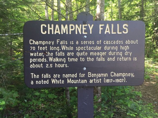
The trail starts at an elevation of 1310 and the cutoff to Champney Falls at 1.35 miles is at 1726. (400 feet in 1.35 miles is very mild). There is a half-mile loop that splits off here to the falls and re-joins the trail at 1.65 miles. We decided to do this loop in the other direction on the way down, so more on this later. By the way, this is a great short hike — to the falls and back.


The loop rejoins the trail 0.3 miles later at an elevation of 1893 which means that this stretch was quite a bit steeper.

It then levels out a little bit (although not as easy as the first part) and continues until it starts approaching the Sisters. At 2.4 miles (2543 feet of elevation) the trail turns right and begins the first of four switchbacks to ease the climb. The switchbacks end at the Champney Falls Cutoff at 2.9 miles (2985 feet). At this point the main trail continues right towards Chocorua and the Cutoff proceeds left for 0.3 miles to the Middle Sister Trail.

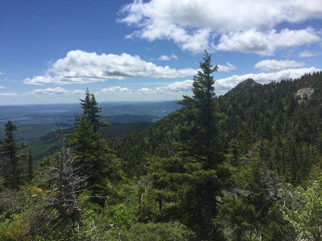
About 0.1 mile in, there is an opening with great views to the west (the Sandwich Range) and to the north. The cutoff was a very pleasant trail with a variety of vegetation including low-bush blueberry, rhodora, black chokeberry, clintonia, bunchberry (pictures later).

Looking back along the path.

The Cutoff meets the Middle Sister Trail in the col between Middle and First Sisters.

We turned left and climbed the 0.2 miles to Middle Sister summit (3302 feet). Both Middle Sister and First Sister summits provide panoramic views in all directions and, of course, the cone of Mt. Chocorua.
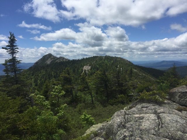
Looking southeast to First Sister in right foreground, with the cone of Chocorua peeking out, and in the left background Silver Lake and Ossipee Lake, quite far away.
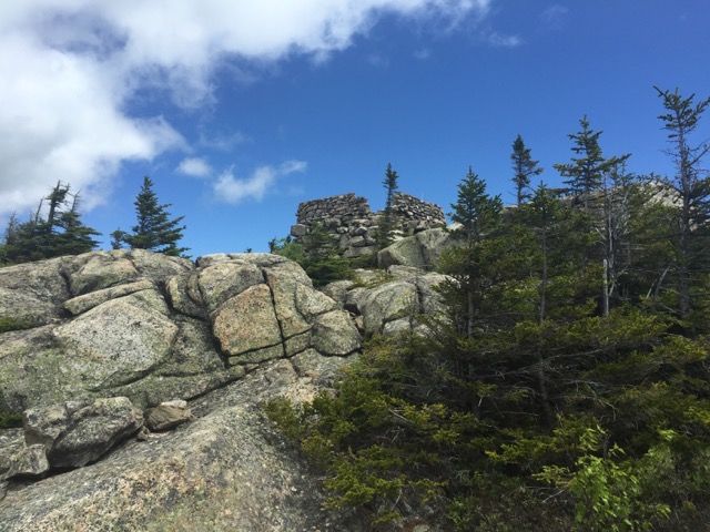
Foundation of old fire lookout station on Middle Sister.
View of First Sister and Mt. Chocorua from Middle Sister.
We then went back down to the col where the Middle Sister Trail met the cutoff, but this time continued south to the summit of First Sister (3328).

After emerging on top of First Sister, we took our standard #Samberging shot with Mt. Chocorua (and its false summit) in the background.

After eating lunch at the top of First Sister we continued south along the Middle Sister Trail another (fairly steep and rocky) quarter mile to its junction with the Champney Brook Trail about 0.3 miles south of the Chimpney Falls Cutoff that we took on the way up. We continued north arriving back to the intersection of the cutoff and the trail and then headed down the way we came.

On the way down we decided to do the loop to Champney Falls. This was definitely a worthwhile diversion (it adds about 0.2 miles total). The falls were very impressive.


We continued around the loop back to the main trail and continued our walk out.
The total trip was 6.7 miles and gains about 2250 feet of elevation. Including lunch and lots of picture stops it took us about 5.25 hours.
Flower time:
Clintonia (Blue-Bead Lily)

Starflower

Black Chokeberry

Rhodora

Pink Lady’s Slipper — white variant

Bunchberry

— Eileen and Larry Samberg - 8-Jun-2016