MA – Quabbin Reservoir – Quabbin Hill and Enfield Lookout Loop
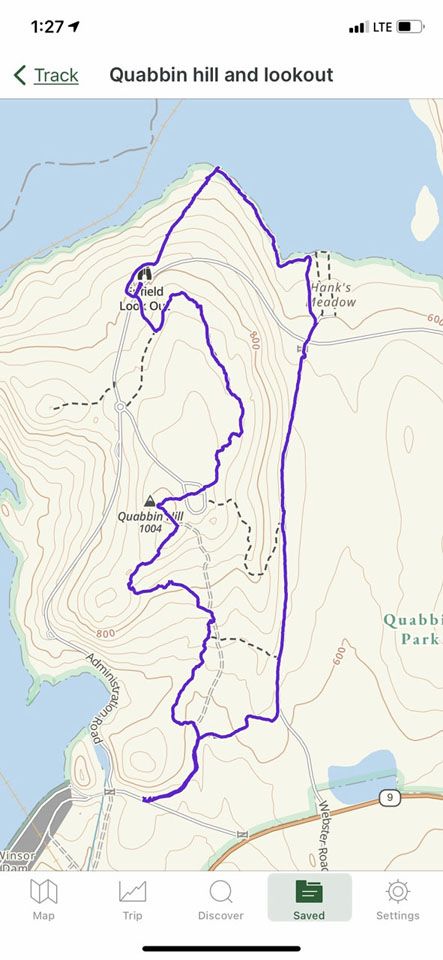
Along with a friend, we hiked a 5.9-6.0 mile loop at Quabbin Reservoir, taking in Quabbin Hill (with the lookout tower, currently closed), and the Enfield Viewpoint, coming back skirting Hanks Meadows. There is a combination of wide trails and narrow trails in the woods and along the reservoir.
The starting and ending point is at the Quabbin Park middle entrance, GPS coordinates: 42° 17.15’N, 72° 20.157W, turning in from Route 9 at the sign that says Winsor Dam Quabbin Reservoir. There is a small parking strip (8 cars) about .3 miles down the road.
Our route:
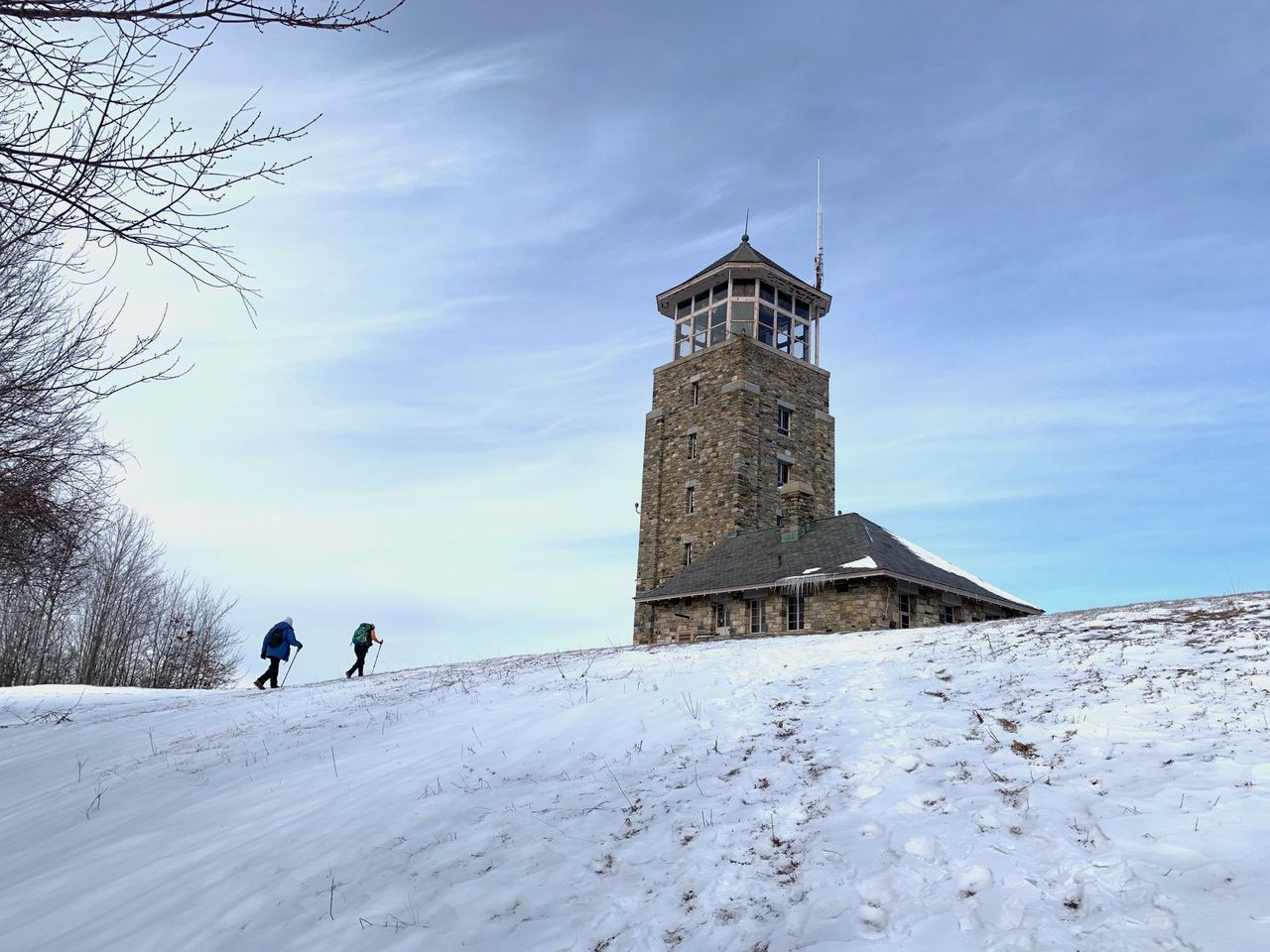
Quabbin Hill Tower.
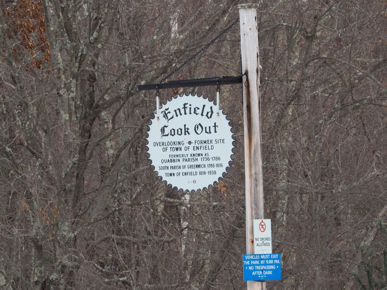
View of Reservoir with Monadnock in the distance from Enfield Lookout.
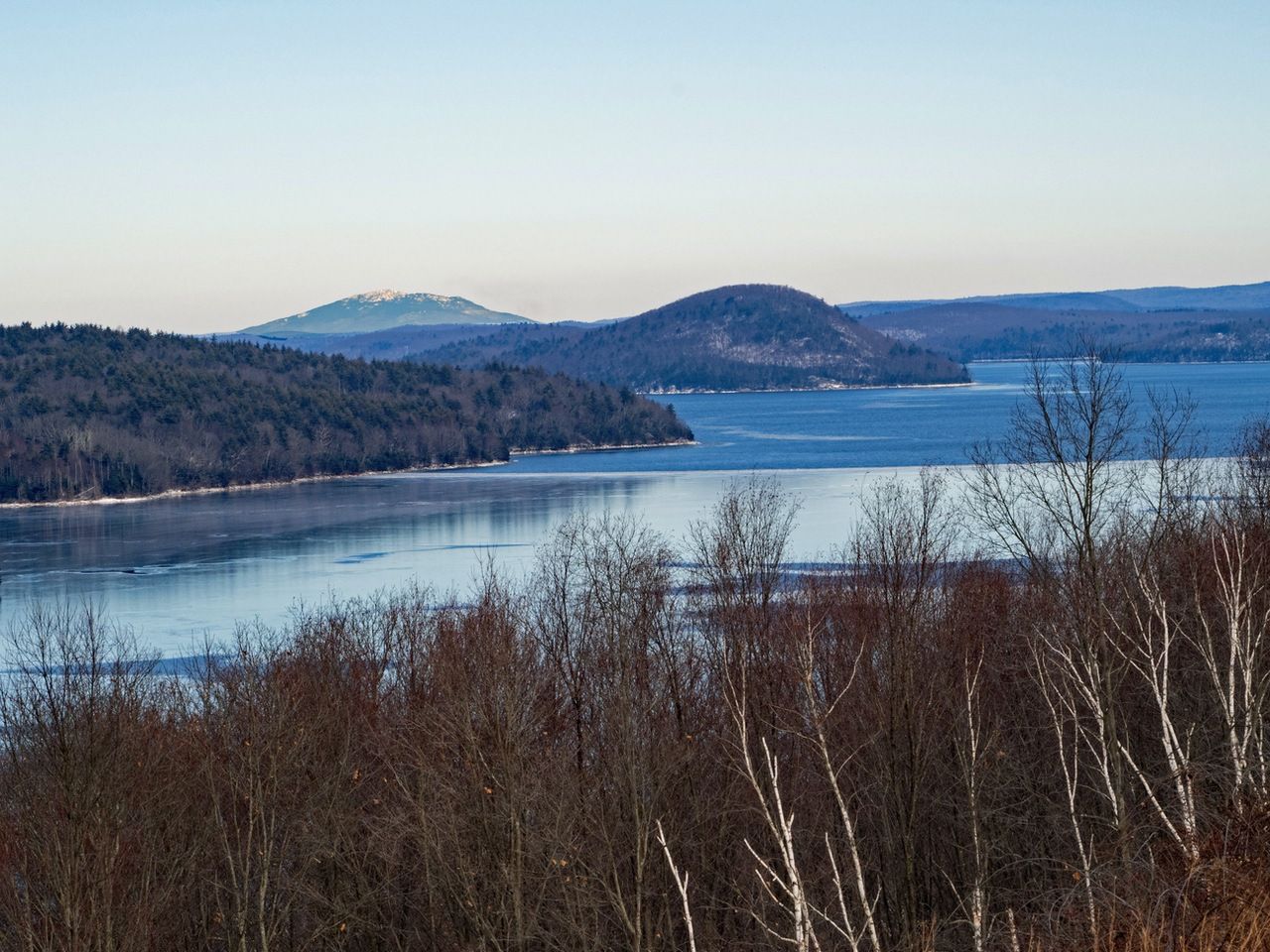
Enfield Lookout. Dana, Greenwich, and Prescott were also flooded.
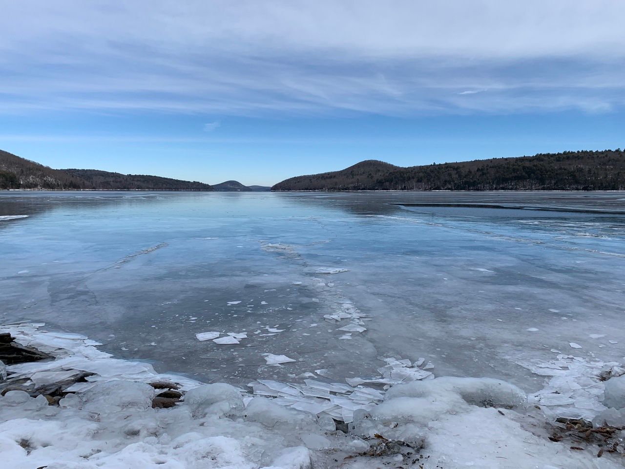
View from Reservoir level.
Ice formation on branches.

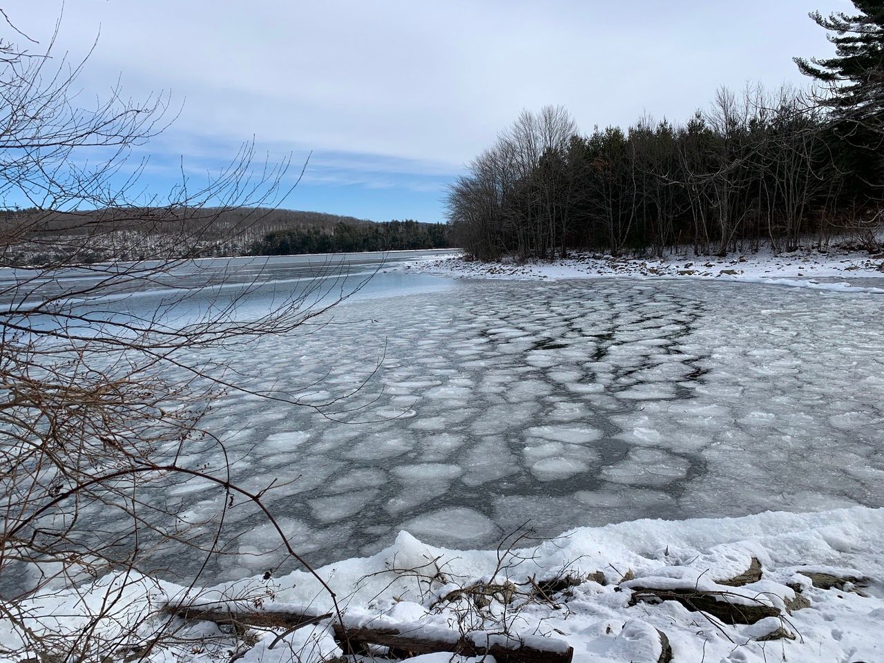
Frozen waves.
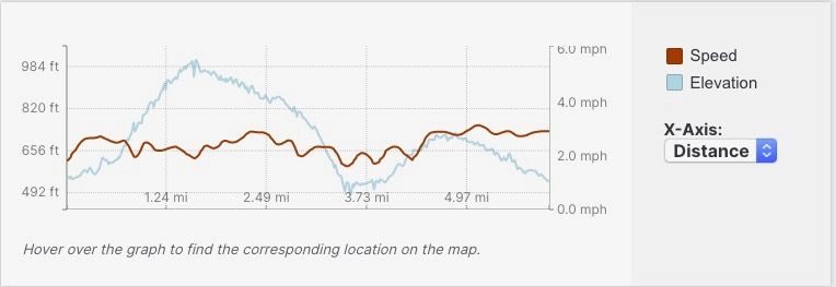
Speed and Elevation.