NH – Mt. Avalon, Crawford Notch
Mt. Avalon is a spur off the ridge comprising the 4000 footers Mts. Wiley, Tom, and Field. At 3420 feet it is #12 on the New Hampshire 52 With A View list. The hike is approximately 1.8 miles and climbs about 1500 feet. Although this is less than our classification for a steep hike (1000 feet per mile), the last third of the hike is steeper. We’ve hiked up Mt. Avalon a few times in the past, but this the first time we have had the opportunity to blog it.
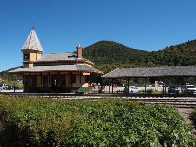
The Mt. Avalon Traill runs from Crawford Depot (elev. 1900 feet) on the west side of 302, to the Willey Range Trail and Mt. Field, with a short spur path to Mt. Avalon along the way.
Crawford Depot
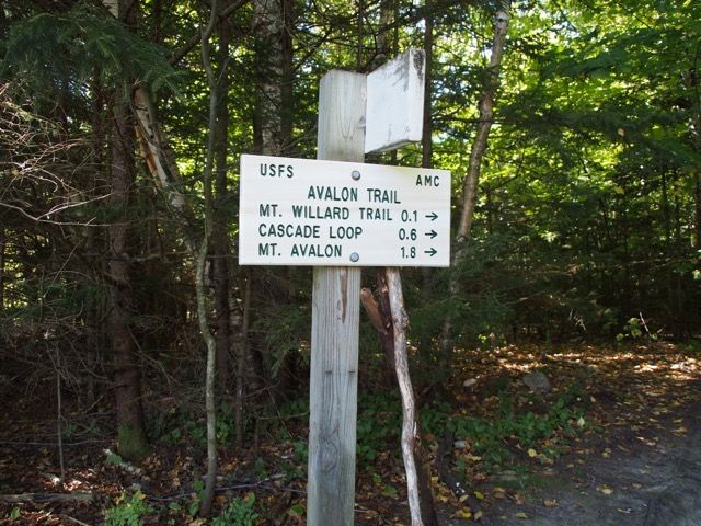
We crossed the railroad tracks and headed up. The Mt. Willard trail leaves left at .1 miles.
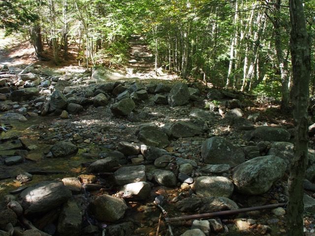
First Crawford Brook crossing at about 0.2 miles. Love the water level in the fall 😃
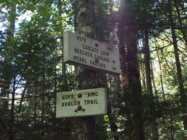
The Cascade Loop is on the left at about 0.25 miles and rejoins at about .4 miles. We did the loop on the return so more on this below.
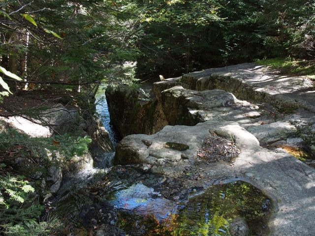
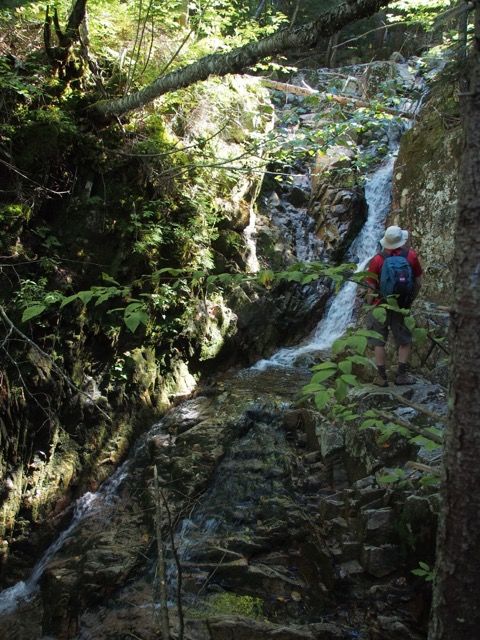
Larry noticed this nice flume along the way.
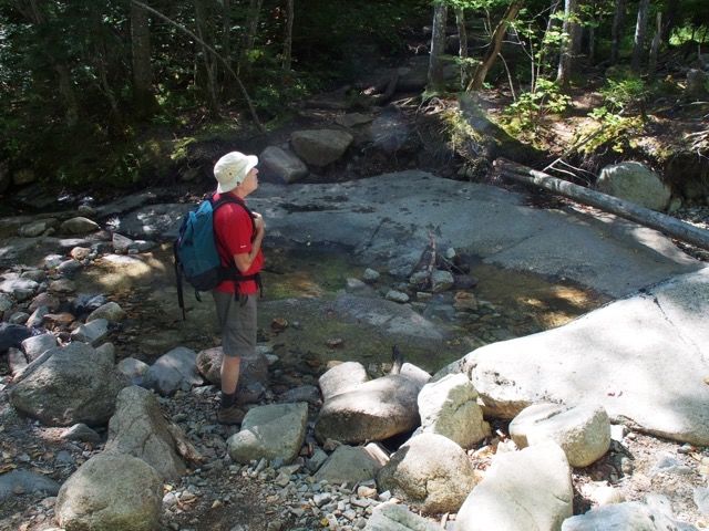
Recrossing the brook (again an easy crossing) around 0.7 miles (elev. 2326), well past where the Cascade loop rejoined.
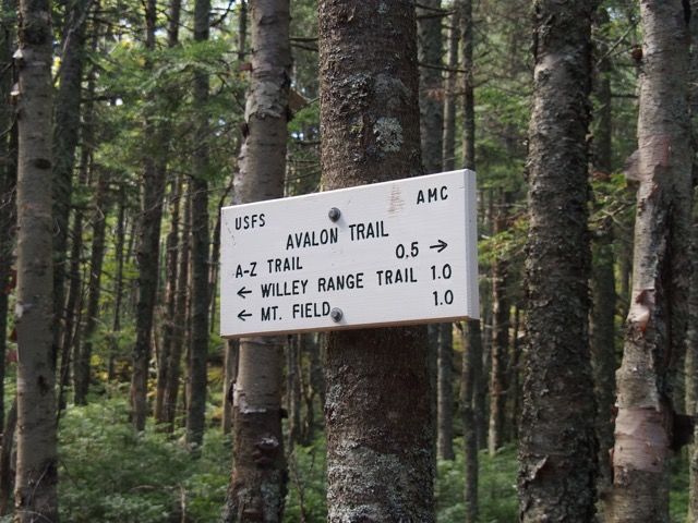
At about 1.3, after moderate grades and short section of steeper pitch, the AZ-Trail diverges right, the Avalon Trail continues left.

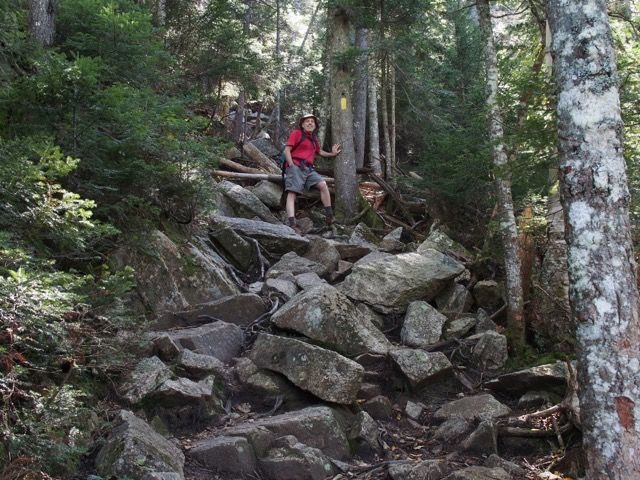
At this point, the pitch gets steeper and rockier.
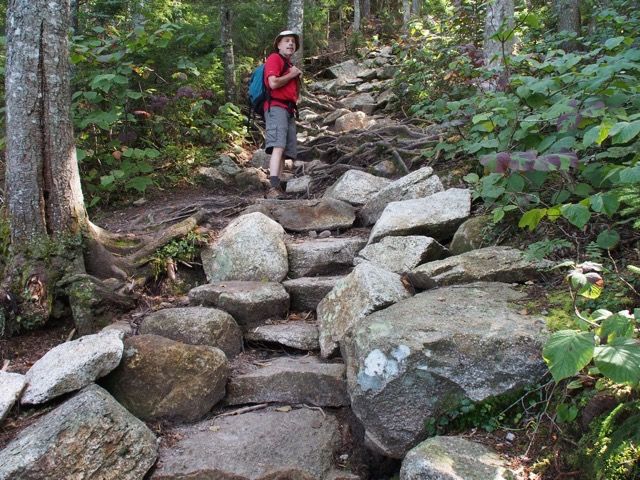
Nice steps at spots along the way.
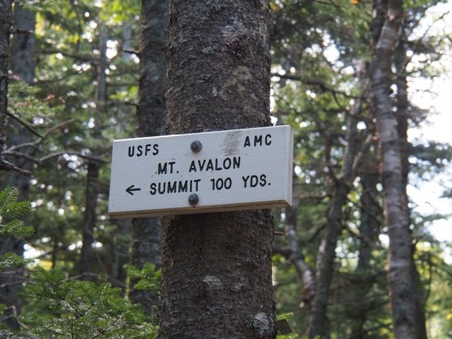
At about 1.8 (elev. 3333 feet) at a small col just below Mt. Avalon, we leave the Mt. Avalon Trail, and head left up the spur to Mt. Avalon, leaving the Mt. Avalon Trail. The spur had a little rock scrambling but it was short and not too difficult.
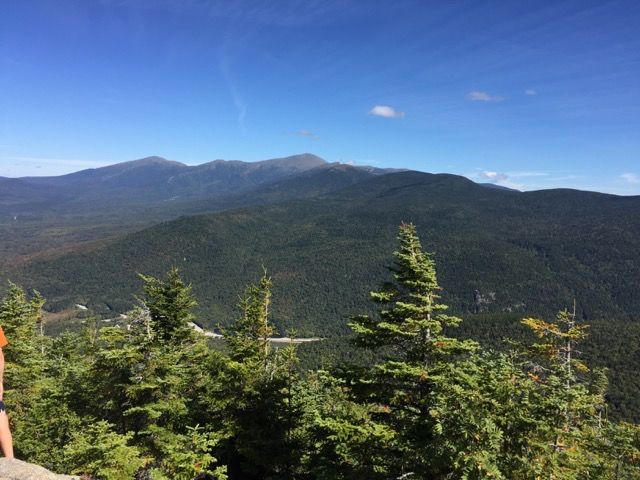
What a day! The Presidentials were glorious — Mt. Jefferson, Mt. Washington, Monroe, Franklin, etc.
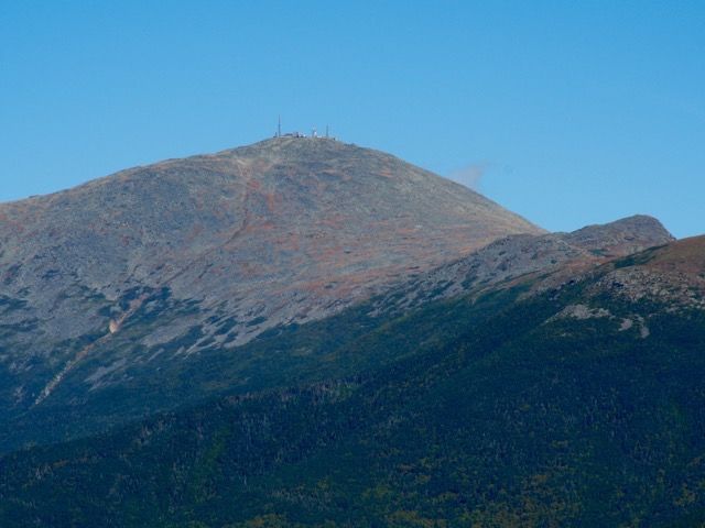
Mt. Washington in its glory.
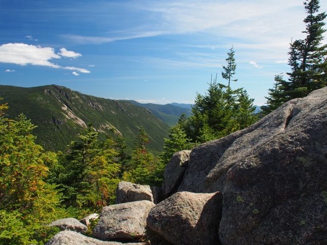
Looking south-southeast towards Jackson and Webster, with Mt. Willard below.
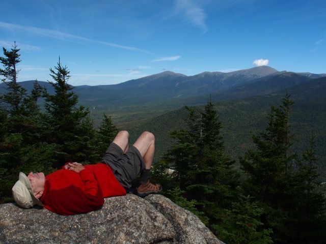
Larry doing his “Samberging" thing.
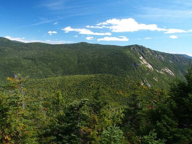
Another view of Mt. Webster and mountains to the southeast.
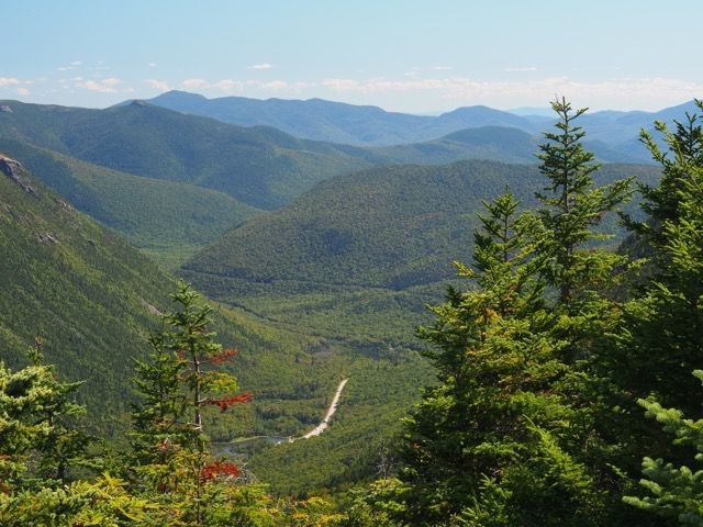
Another look southeast, showing Rt. 302 and the Crawford notch railroad line etched into the mountainside.
We took the Cascade loop on the way back. This is the Pearl Cascade.
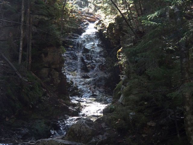
And the Beecher Cascade.
The hike.
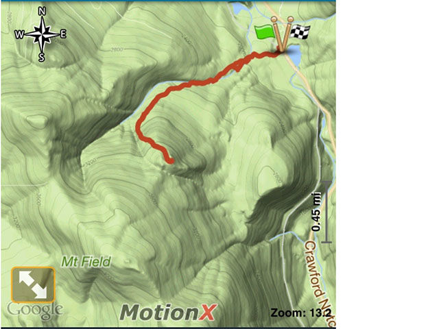

The hike was about 3.6 miles, 1.8 miles each way, starting at 1,900 feet and rising to 3,421 feet. We took our time, took pictures of flowers, relaxed for a long while on top of Mt. Avalon, taking about 4 hours total.
The only harder parts of the trip was a short moderately steep section before the junction with the A-Z trail, and a rockier steeper section after the A-Z Trail.
— Eileen and Larry Samberg, 16-Sep-2016